Sunday 10 February 2019

Looe, Cornwall On A Cloudy Day

Looe Beach, Cornwall
Yesterday's Post featured Polperro. Just along the coast is Looe. The photo was taken on a cloudy day, just before the rain arrived. But people still looked for treasures along the beach.

Saturday 9 February 2019

Walking The South West Coast Path Into Polperro, Cornwall

South West Coast Path near Polperro
A few photos walking the South West Coast Path and approaching the village of Polperro.
Walking on South West Coast Path, Cornwall
Lots of ups and downs as we walk the coastal path. In the photo below you can just see the top of the small Polperro lighthouse at Spy House Point. Built in 1911, it is only ten feet tall but the light can be seen for eight miles. There is a track down to the lighthouse.
Polperro lighthouse, Cornwall
The path gradually starts to go downhill.
South West Coast Path, Cornwall
Finally we reach the outskirts of Polperro - still downhill!
Path leading down to Polperro, Cornwall
At last, Polperro harbour and the tide is out. The old fishing village is like stepping back in time, with cottages clinging to the hillside - a great place to visit.
Polperro, Cornwall when the tide is out

Friday 8 February 2019

Par Sands : Photos of Beach and Surroundings

Grasses on the sand dunes at Par, Cornwall
Grasses on the sand dunes at Par
We were passing Par Beach - or Par Sands as it is now known - and decided to stop so I could snap a few photos. It's not my favourite beach by any means, but many years ago we owned a couple of caravans here which we let out to holiday makers. So, in a way, the visit was to see how the area has improved.

Golden grasses are still on the sand dunes. The beach is very flat and the tide goes out quite a long way, leaving seaweed and the like behind. To the nearside of the beach the scenery is very pleasant - and it's possible to walk along the cliffs for many miles.
Beach at Par, Cornwall
Par Beach, with the tide out
A few large rocks are on the far side of the beach but ...
Rocks on the beach at Par, Cornwall when the tide is out
Rocks on the beach
... unfortunately, also on the far side of the beach is a clay factory, though it is reasonably hidden.

China Clay works next to Par Beach, Cornwall
Clay works at the far end of the beach 
The beach is a favourite with dog walkers at this time of year.
Walking dogs on Par Beach, Cornwall
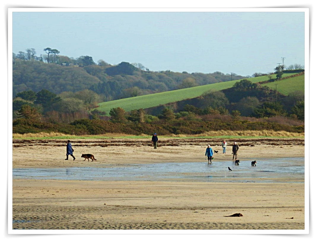
Dog walkers on the beach
There are many holiday caravans and a few chalets at the back of  the beach. All very neat and tidy - and far superior to the ones we used to let out. Times have changed, holidaymakers expect much more nowadays.

Holiday caravans at Par Beach, Cornwall
Caravans at Par Sands
Par Beach has it's own lake with geese, ducks, swans and other birds
Lake at Par Beach, Cornwall
Seagull on watch at the lake
Children enjoy feeding the ducks here, but the swans and geese can be a little overwhelming for small tots.
Ducks, geese and other birds at Par Beach lake
Geese, ducks and other birds at the lake
Chalets at Par are on the far side of the lake and some overlook the water, again all very neat and tidy.
Lake at Par Beach, Cornwall
Chalets at Par Sands

Thursday 7 February 2019

The Mysterious Creatures Guarding Helman Tor, Cornwall

Dinosaur style rock at Helman Tor, Cornwall
The granite dinosaur casts his eye over Bodmin Moor. He has a good vantage point as he silently observes from the top of Helman Tor. The views stretch for miles. On a clear day it is said that Cornwall's south and north coastlines can be seen.
View from top of Helman Tor, Cornwall
As well as the dinosaur there is a giant turtle or maybe a tortoise.
Rock that looks like a tortoise or turtle at Cornwall's Helman Tor
Okay, okay, a stretch of imagination perhaps, but there are many strange shapes created by the natural granite boulders on Helman Tor. It's fun to see where your imagination takes you.

The shapes and scenery have been viewed by man since Neolithic times - some 4000 years ago. A settlement was created here and homes erected from stones and rocks. Some of the later boundary walls can still be seen - they are there to be touched.

The prominence of the Tor in the landscape may have given the settlement a strategic position for ceremonial and economic functions - a place to meet, worship and trade.
Wild scenery at Helman Tor, Cornwall
Over the years the granite boulders and rocks have created such strange shapes and patterns on the landscape.
Granite rocks at Helman Tor, Cornwall
Huge granite rocks at Helman Tor, Cornwall
The weather can change quickly on the moors, as perhaps the photos illustrate - from bright blue to drab skies as the wind directions change.
Layered granite rocks at Helman Toe, Cornwall
The photo below shows the Helman Tor Logan Stone or Men Omborth in the Cornish language,

Logan stones are balance stones - they can sometimes be moved by hand despite their great weight. It is believed that Druids used these for their rites and rituals. Uneducated people would believe that the priests had magical powers as they moved such huge granite boulders without any effort.

Logan stone at Helman Tor, Cornwall
Helman Tor is away from the main Cornish tourist trail and is reached by driving or walking along very narrow roads - which are often single track. So, if driving you have to keep fingers crossed that nothing is coming in the opposite direction - as one of you will have to be good at reversing!

When visiting the Tor I have rarely seen any other people. Though on one occasion I did see many wild ponies at the top - which was quite magical.
Map showing Helman Tor

Wednesday 6 February 2019

The Cave On Charlestown Beach, Cornwall

Cave at Charlestown, Cornwall
Cave on Charlestown Beach
Yesterday's Post was about a walk along Charlestown beach in Cornwall, What I didn't mention was that there is a small cave in the cliffs - as per the photo above.
Inside cave at Charletown Beach, Cornwall
Inside Cave
On Sunday the floor of the cave - above photo - was running with water but still possible to go inside. inside.
Hole in roof of cave at Charlestown, Cornwall
Looking Upwards
This is the strange bit. If you look upwards there is a hole right through to the top of the cliffs. Now what is that for? There is an explanation - but it could well be a load of baloney! But here it is.

We go back to the days of smuggling. The smugglers would beach their boat and rush their contraband to the cave. There would be a rope dangling through the hole and this would be used by the smugglers associates to heave the goods to the top. They could then transfer the smuggled goods to a safe house - and the boat would  sail away before the customs men could take any action.

A bit fanciful perhaps!

The rocks and stones below are just because I quite like rocks and stones.
Stones and rocks on Charlestown Beach, Cornwall
Rocks & Stones, Charlestown Beach

Tuesday 5 February 2019

Walking The Beach At Charlestown, Cornwall

The Port and cottages at Charlestown, Cprnwall
Charlestown
It was such a lovely morning on Sunday: cold, but mostly blue sky. We had a stroll around Charlestown harbour and then onto the stony beach via the tunnel.
Tunnel at Charlestown, Cornwall leading to beach
Tunnel and steps to Charlestown Beach
The tide was out and the cliffs looked at their best.
The cliffs at Charlestown, Cornwall
The cliffs at the end of Charlestown beach
We walked the full length of the beach - no great achievement as it's only a short distance - and reached the final rocks and stones, where we sat to enjoy the sunshine for a few moments.
The cliffs and rocks at Charlestown, Cornwall
Rocks and stones at the end of Charlestown beach
We then did an about turn and meandered back to the harbour, while looking for interesting pebbles and stones. There were lots of rock pools as the tide was still fully out.
Looking towards the harbour from the Charlestown stony beach
Returning to Charlestown Harbour

Monday 4 February 2019

Lerryn Bridge, Cornwall and How It Looked In 1890

Lerryn Bridge, Cornwall
How Lerryn Bridge Looks Today
For those who know me through Google+ the above photo may be familiar as this is on my home page. As readers may know Google+, in the company's words, is going away on 2 April 2019 - in other words it is closing.

Anyway, no matter, the photo above is of Lerryn Bridge in Cornwall and surprise, surprise the vintage photo below is how the same scene would have looked in 1890. Not too different really - other than the children may well have moved on since then!
Vintage photo of Lerryn Bridge
How Lerryn Bridge Looked in 1890
Lerryn is a beautiful spot by the river and there is a lovely walk starting by the bridge. No doubt, when the weather improves, I'll snap a few photos of the walk for this blog.

In the 1500s and 1600s smuggling was a way of life in the village. One of the lanes is called Brandy Lane, named after the smugglers favourite tipple. In the nearby Ethy woods there is an entrance to a tunnel which is said to lead to Ethy House - where the contraband was stashed and hidden from the Excise Men.

There's usually a story in Cornwall!

FEATURED POST

My Garden in Cornwall

There still isn't much colour in our garden at the moment, here in Cornwall. I think Spring must have forgotten us.  On the opposite  ...