Sunday, 2 June 2019
Walking to Gribbin Head Cornwall - Daphne du Maurier Country
A visit we made - well, one we do often - to Gribbin Head with it's Gribbin tower. This is such a lovely stretch of coastline and one which inspired the writer Daphne du Maurier to write books such as Rebecca.
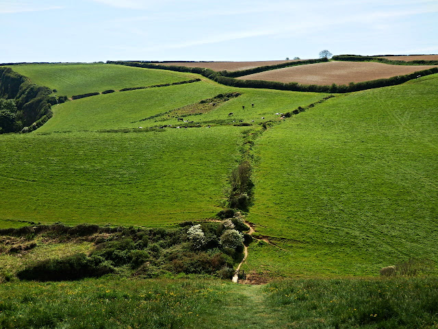
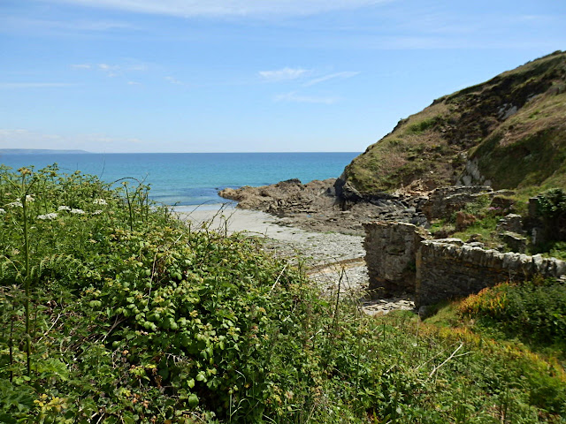
We parked the car at Menabilly and walked through the fields to Polridmouth - the beach above - and also the ornamental lake as below.
During the second world war Polridmouth was used as a decoy site. Lights were placed around the ornamental lake to lure enemy bombers away from nearby Fowey harbour, particularly during the build up to the D-Day invasion when 2,000 American troops were stationed in and around Fowey town.
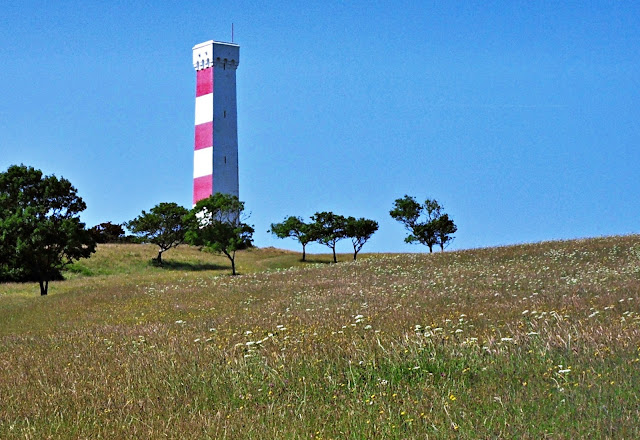
I digress! We were actually walking to Gribbin Head and to Gribbin tower - that's the tower in the photo below.
It's a bit of a hill to climb but worth it for the views.
Gribbin Head has been an important lookout for many centuries. Iron Age people and medieval farmers settled on this viewpoint.
In Elizabethan times the Gribbin was a beacon site which, in 1588, helped carry the news to London of the approaching Spanish Armada.
Since 1832 the Gribbin (tower) has been an 84 ft. daymark to enable ships and other craft to pinpoint the approach to Fowey's harbour.
The detail below is over the door into the Gribbin.
There are lovely views and it's possible to continue walking along the coast path for many miles.
The photo below shows the entrance to the Fowey River and the harbour beyond. This is the entrance often missed by ships prior to the daymark being built.
Walking down the hill the views continue.
It's interesting that prior to 1988 the brow of the Gribbin was covered in dense scrub. Since then cattle grazing has been introduced and the grassland is now herb rich. In summer there is a variety of wild flowers and plants to be found.
I love this stretch of coast, such wonderful views and it's an essential place for any Daphne du Maurier fans to visit. The area brings her books alive.
See Also:
The Wonderful Coastline At Menabilly - Daphne du Maurier Country
Daphne Du Maurier Featured On Large Cornish Mural
Beyond The Beacon Near Du Maurier's Manderley / Menabilly
Thursday, 30 May 2019
Walking The Cliffs In North Cornwall - 14 Photos
I like walking along cliff tops, not too sure why as I'm not quite so good at heights nowadays. Somehow though I feel in tune with the cliffs and the sea vistas - if that doesn't sound to fanciful.
We were on Cornwall's north coast and set out walking from Compass Point heading towards Widemouth Bay.
The tide was out so lots of views of rocks and stones far into the distance.
We met a few others walking along the cliff tops, but not too many as it was quite a breezy day.
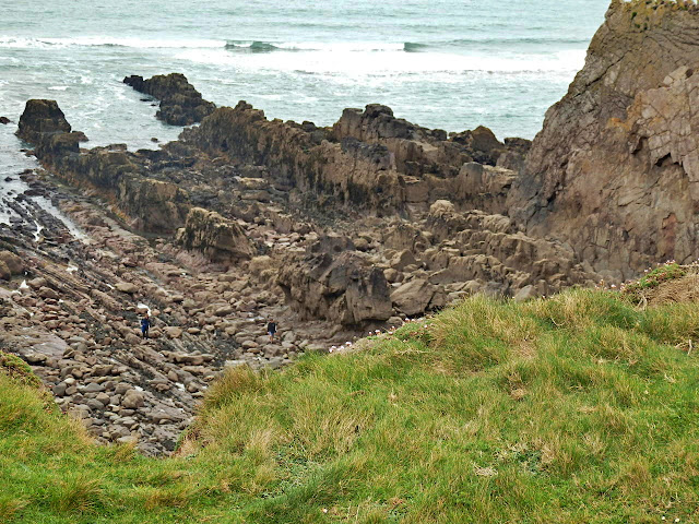
In the photo below you might just be able to make out two men on the rocks below - to the left of the photo. It's easy to get cut off if you don't treat the tides with respect.
The surface of some of the cliff top walk is covered in grass - so makes the walking quite comfortable other than the path goes up and down.
The cliffs seemed to get higher ...
... quite a drop. Birds nest in the cliffs safe from walkers.
A few flowers cling to the cliff tops.
Inland there were now houses to be seen and green fields with a few horses.
We reached Trig Point (below) and then continued past Efford Ditch. We carried on walking but then realised it must be nearly three miles back to the car - so we turned around and retraced our footsteps.
A trig Point, by the way, is used in the UK to mount and centre a theodolite used to take angular measurements to neighbouring trig points.
It started to drizzle with rain so we were glad to see Compass Point again.
By the time we reached Compass Point - the round building in the photo below - the rain had fortunately ceased.
Compass Point is a former coastguard lookout and was built in 1840 but was moved to it's current position in 1880. It is made from local sandstone and the design is said to be based on the Tower of the Winds in Athens. As you can see, in the photo below, it has the points of the compass on each of its octagonal sides.
Tuesday, 28 May 2019
The Canal at Bude, Cornwall Built In 1825.
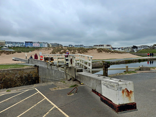
When visiting Bude I was fascinated by the canal, which has only two locks. It's no longer used for carrying goods but there are a few pleasure craft on the water - photo above.
The three photos below show the lock and some of the workings at the Bude harbour end of the canal.
As I understand it plans were made to create a canal way back in 1774. The local sand is full of minerals and is used by farmers as a soil conditioner and enhancer. However the plans for the canal were thwarted until an Act of Parliament was obtained in 1819 giving permission for the work to begin.
The first 35 miles of canal were completed by 1825 and there were high hopes of big profits carrying sand and other goods.
The building of the canal was quite a feat as it had, as mentioned, only two locks and also six inclined planes.
It became the first canal in the UK and second in the world to use water-powered tub-boat inclines, and it had the most inclined planes of any waterway.
Now I don't profess to fully understand inclined planes so I think I'll have to quote from Wikipedia :
"The unusual feature of the canal was the six inclined planes. The tub boats had wheels, and on the inclined planes they were pulled up the slopes with the wheels running in channel rails (like a squat letter "U" in section). There were two sets of rails, one for each direction, but it does not appear that a counterbalancing system was used (in which a boat coming down would balance one being pulled up).
The tub boats were hauled up and let down the inclined planes by chains, which were operated in most cases by waterwheels; the transit took five minutes or so."
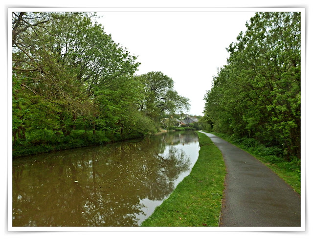
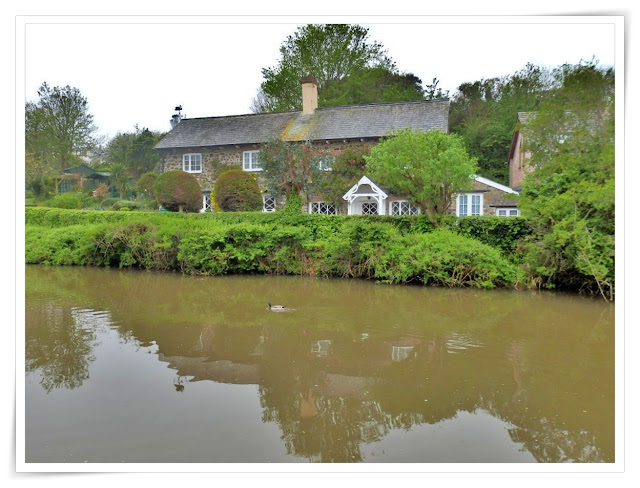
Once completed the canal cut the cost of sand by as much as three-quarters. All well and good until, that is, the railway arrived in Bude in 1898. Those big expected profits never materialised. Today the canal looks very attractive and there is a walkway running alongside for walkers and cyclists - as photo above. Unfortunately it was raining when we walked along the path but there is much to see. There are some attractive old cottages, as below, and so on.
Off to the side, at the Bude end, there are nature reserves for birds and other wild life.
We had a pleasant walk alongside the canal despite the rain. Several men were fishing - they need a licenc. There was no sign of any catches, but they seemed happy enough!
More information on the Bude Canal can be found on the Bude Canal and Harbour Society website.
Sunday, 26 May 2019
Bude Beach, Beach Huts, Swimming Pool and Pies!
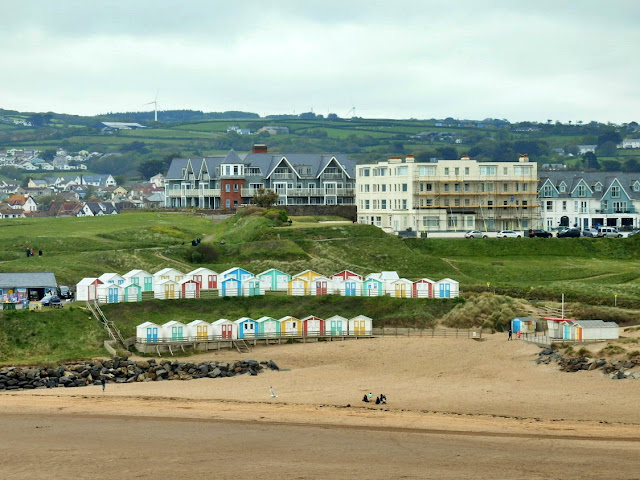
A few photos of Bude, Cornwall where it seems that beach huts are very much in vogue.
It's a sizeable beach when the tide is out. It is then possible to walk a long way beneath the cliffs.
The rock with, what looks like an aerial, is Chapel Rock which I have mentioned in a previous post.
The old cottage below has an prime position overlooking the beach.
Bude has it's own Sea Pool, which gets filled twice a day at high tide - admission is free.
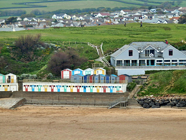
And there are even more Beach Huts!
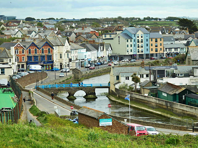
And finally looking towards the town of Bude. We didn't venture fully into the shopping centre but did manage to visit the Cornish Pie Company. Just a small shop, but friendly staff and the pies are very tasty - well at least mine was!
Friday, 24 May 2019
An Easy Walk at Pentewan, Cornwall Taking In Trees, Sea, Sand, Cliffs and a Private Cove For Lunch
Tuesday was such a lovely sunshine day that we didn't want to miss, so we went for an easy walk to the small cove in the photo above. We started at the Pentewan Trail, Cornwall by the bridge. There is a pull-in nearby for a few cars.
The trail, or path is for walkers and cyclists and it winds it's way alongside a small river and then through the trees.

The trail ends at the small village of Pentewan. The harbour is now land locked. A hundred years ago it would have been a hive of activity - see photo from 1900 here.
There is a beach at Pentewan, but it wasn't too busy.
Behind the beach there is the popular Pentewan Sands Holiday Park. This has static caravans, and also lots of room for touring caravans, motor homes and camping. It gets very busy in the main summer season.
We walked through Par Sands to make our way to the coast path. It starts out quite steep as it meanders its way to Mevagissey. Looking back from the path are views of Pentewan and beyond - notice how the road from Pentewan climbs to the top of the hill!
The coastal path goes up and down ...
... as can be seen from the photo below ...
... and also the next photo.
We decided not to walk too far along the coastal path and made our way to a small cove.
The cove was perfect as there was no one else in sight! We sat on the rocks and had our lunch - a Cornish pasty for my wife and a vegetable pasty for me, plus a Danish pastry each - and tea, of course. Could life get any better!
We sat and watched the tide gradually going out.
We decided to walk back via the sand that was now visible. There were a few rocks to scramble over but then the sand was soft to walk.
Cliffs and rocks are always interesting.
We soon reached Pentewan Beach - much quicker than the ups and downs of the coastal path. From here it was retracing our steps until we reached the bridge (as in the 2nd photo) and our car.
It's days like this that make me realise how lucky I am to live in Cornwall.
Subscribe to:
Comments (Atom)
FEATURED POST
Cornwall's Lizard Peninsula
I know my wife and I and live in Cornwall but we had a break away from home on Cornwall's L izard Peninsula - one of our favourit...


