Tuesday, 29 October 2019
Walking Through The Lost Gardens of Heligan, Cornwall
In a recent blog post I mentioned that The Lost Gardens of Heligan had been Voted UKs Top Visitor Garden. I think one of the reasons is that there is always something different to view as the seasons change. Today's photos were all taken on in October.
The Giant's Head, as in the photo above, is found in Heligan's woodland walk along with the Mud Maid.
Below is an entrance to one of the formal gardens but ...
… on our visit we headed for the green fields. Wet underfoot but the sky was doing its best to brighten the way.
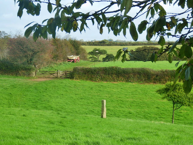
Looking across the fields the rain has made them a lovely shade of green.
In an adjoining field an old fashioned hay wagon can be seen. This is still all part of Heligan.
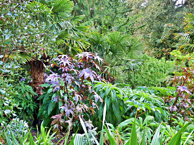
Moving on we come to the jungle.
After all of the rain and dampness it's a good time to spot various fungi. The display below looks like the head of some sort of cattle - or perhaps that's just my imagination.
The palm tree below is losing some of it's outer covering.
Flowers at last, though dotted with raindrops.
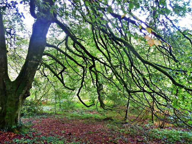
More like a woodland walk now ...
… with a path leading through the trees.
The pathway meanders by the some ferns.
Then a display of flowers, good to see in October.
And finally, passing by one of the greenhouses I noticed the staff had made a small display inside.
That's the end of our walk, but we have only covered a very small part of The Lost Gardens of Heligan's 200 acres.
To see many more photos of the Lost Gardens of Heligan just enter 'Heligan' into the search box at the top of this blog to the right.
Saturday, 26 October 2019
Carlyon Bay, Cornwall: Sand, Sea and Cliffs
It had been a rough morning weather-wise. When the rain stopped we decided to have a quick walk along the beach at Carlyon Bay to blow the cobwebs away.
The sky gradually improved so I snapped a few quick photos - nothing too special. Not like the time we had a meeting with barrel jellyfish.
Not many people about. The rusty looking fence, to the left of the photo above, is part of the supposed redevelopment of Carlyon Bay. There are plans to build a beachside village here - but this has been said for many, many years. Details of the proposed development can be seen here. I'll believe it when I see it!
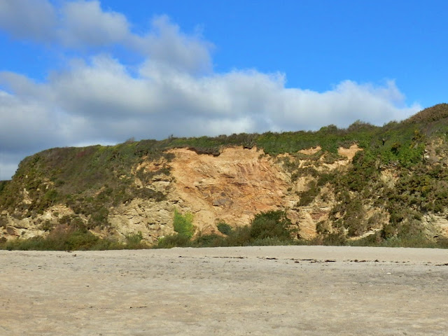
At the back of the beach are cliffs - it's quite pleasant walking along the coastal path at the top of the cliffs.
As the weather had been a bit rough there was a line of seaweed and shells on the seashore.
I was hoping to find treasure rather than sea shells - but, as usual - we took a few shells home.
The photo below may seem a bit strange but a river of water runs across the beach from the cliffs and cuts its own path across the sand. Somehow any developers would have to solve this problem.
Another view of the cliffs. Oh, and if you walk to the far end of the beach in the summer months beware of nudists!
Wednesday, 23 October 2019
Walking From Ready Money Cove, Fowey to Gribbin Head, Cornwall
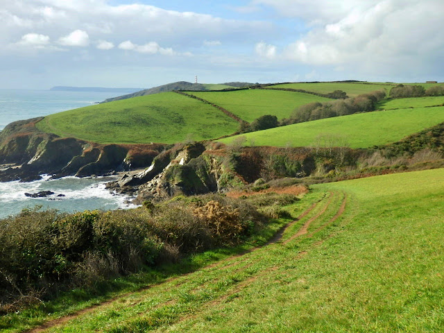
Today's post continues walking from St. Catherine's Castle, near Ready Money Cove, Fowey towards Gribbin Head - shown in the photo above.
On leaving the castle I looked back at Dawn French's £3,000,000 mansion on the cliffs at Ready Money cove - to the left of the photo. For overseas readers Dawn is a well known actress, writer, comedian and presenter in the UK. A lovely spot to have a house.
The Fowey River is also in view.
I passed through Covington Woods without realising I had done so.
The initial coastal path is along the cliff tops. A strange thing is that, on my complete walk, I only saw two other people - which was quite nice!
There are a few coves on the route to scramble down if so inclined.
Otherwise the coastal path continues with quite a few ups and downs. The cove shown is Coombe Haven.
Part of the coastal path is looked after by the National Trust.
The countryside changes with green fields, at their best because of all the recent rain.
Gribbin Head comes into view. The red and white striped daymark can just be seen, on the skyline, towards the right of the photo below.
The path continues along the cliff tops to Gribbin Head and some of my favourite countryside.
The final hill to Gribbin Head.
Of course walking such a path normally means having to either retrace your steps back to the start, or having someone pick you up at your destination. Whatever, it's a lovely walk.
Sunday, 20 October 2019
St. Catherine's Castle, near Ready Money Cove, Fowey, Cornwall
I had a free morning and decided to head for St.Catherine's castle high on the cliffs next to Ready Money Cove, Fowey.
As can be seen in the black and white photo above the castle is partly a ruin.
I parked my car in a side road and walked along the Esplanade towards Ready Money Cove. The castle can just be seen in the photo below.
I reached Ready Money Cove. The tide was out and all was peaceful. Hard to believe it gets so packed with visitors during the summer season.
There is a set of steps from the beach, which heads up to a coastal path. The climb is quite steep. The path was quite muddy.
While climbing the path there are some great views of Ready Money Cove and ...
… the Fowey River.
And finally St. Catherine's Castle is reached. There is a sign (entrance is free) which reads:
The tower's heavy guns protected Fowey harbour from enemy ships. Walls with musket loopholes are later additions. In 1855 two heavy guns were installed in circular positions below the tower.
Below shows one of the heavy gun positions mentioned above.
The next photo illustrates how the castle was positioned to protect the entrance to the Fowey River. On the opposite side of the river is Polruan.
There are a few steps to climb to reach the inside of the tower itself.
A couple of musket loopholes.
Leaving the tower there are views along the Fowey River.
A warning sign about the 'steep drops'.
Looking across from the castle to Polruan another small castle, known as a Blockhouse, can be seen on the water's edge. This was erected in the 15th century, again for the defence of the Fowey River.
It was linked by a large chain with a similar Blockhouse on the Fowey side of the river. The chain could be raised to stop unwanted ships entering the harbour - and was last used way back in 1666.
That concludes my visit to St.Catherine's Castle - but first a quick note about car parking.
The car parks in Fowey can quite expensive, but at this time of year (October to April) I park on roads where there are single yellow lines. See sign below which verifies this is okay. Always double check the signs though.
And a final note. Driving into Fowey there is a right turn and then markings which tend to lead you into a carpark. Ignore these (between October and April) and head straight along the road where there are some lovely views - as the early morning photo below.
As can be seen in the black and white photo above the castle is partly a ruin.
I parked my car in a side road and walked along the Esplanade towards Ready Money Cove. The castle can just be seen in the photo below.
I reached Ready Money Cove. The tide was out and all was peaceful. Hard to believe it gets so packed with visitors during the summer season.
There is a set of steps from the beach, which heads up to a coastal path. The climb is quite steep. The path was quite muddy.
While climbing the path there are some great views of Ready Money Cove and ...
… the Fowey River.
And finally St. Catherine's Castle is reached. There is a sign (entrance is free) which reads:
ST. CATHERINE'S CASTLE
KASTEL S. KATTRIN (Cornish language)
A gun tower built 1538-40 by Thomas Treffry for Henry VIII (reigned 1509-47) as part of a national defence programme.
The tower's heavy guns protected Fowey harbour from enemy ships. Walls with musket loopholes are later additions. In 1855 two heavy guns were installed in circular positions below the tower.
Below shows one of the heavy gun positions mentioned above.
The next photo illustrates how the castle was positioned to protect the entrance to the Fowey River. On the opposite side of the river is Polruan.
There are a few steps to climb to reach the inside of the tower itself.
A couple of musket loopholes.
Leaving the tower there are views along the Fowey River.
A warning sign about the 'steep drops'.
Looking across from the castle to Polruan another small castle, known as a Blockhouse, can be seen on the water's edge. This was erected in the 15th century, again for the defence of the Fowey River.
It was linked by a large chain with a similar Blockhouse on the Fowey side of the river. The chain could be raised to stop unwanted ships entering the harbour - and was last used way back in 1666.
That concludes my visit to St.Catherine's Castle - but first a quick note about car parking.
The car parks in Fowey can quite expensive, but at this time of year (October to April) I park on roads where there are single yellow lines. See sign below which verifies this is okay. Always double check the signs though.
And a final note. Driving into Fowey there is a right turn and then markings which tend to lead you into a carpark. Ignore these (between October and April) and head straight along the road where there are some lovely views - as the early morning photo below.
Subscribe to:
Posts (Atom)
FEATURED POST
Cornwall's Lizard Peninsula
I know my wife and I and live in Cornwall but we had a break away from home on Cornwall's L izard Peninsula - one of our favourit...


