I had a free morning and decided to head for St.Catherine's castle high on the cliffs next to Ready Money Cove, Fowey.
As can be seen in the black and white photo above the castle is partly a ruin.
I parked my car in a side road and walked along the Esplanade towards Ready Money Cove. The castle can just be seen in the photo below.
I reached Ready Money Cove. The tide was out and all was peaceful. Hard to believe it gets so packed with visitors during the summer season.
There is a set of steps from the beach, which heads up to a coastal path. The climb is quite steep. The path was quite muddy.
While climbing the path there are some great views of Ready Money Cove and ...
… the Fowey River.
And finally St. Catherine's Castle is reached. There is a sign (entrance is free) which reads:
ST. CATHERINE'S CASTLE
KASTEL S. KATTRIN (Cornish language)
A gun tower built 1538-40 by Thomas Treffry for Henry VIII (reigned 1509-47) as part of a national defence programme.
The tower's heavy guns protected Fowey harbour from enemy ships. Walls with musket loopholes are later additions. In 1855 two heavy guns were installed in circular positions below the tower.
Below shows one of the heavy gun positions mentioned above.
The next photo illustrates how the castle was positioned to protect the entrance to the Fowey River. On the opposite side of the river is Polruan.
There are a few steps to climb to reach the inside of the tower itself.
A couple of musket loopholes.
Leaving the tower there are views along the Fowey River.
A warning sign about the 'steep drops'.
Looking across from the castle to Polruan another small castle, known as a Blockhouse, can be seen on the water's edge. This was erected in the 15th century, again for the defence of the Fowey River.
It was linked by a large chain with a similar Blockhouse on the Fowey side of the river. The chain could be raised to stop unwanted ships entering the harbour - and was last used way back in 1666.
That concludes my visit to St.Catherine's Castle - but first a quick note about car parking.
The car parks in Fowey can quite expensive, but at this time of year (October to April) I park on roads where there are single yellow lines. See sign below which verifies this is okay. Always double check the signs though.
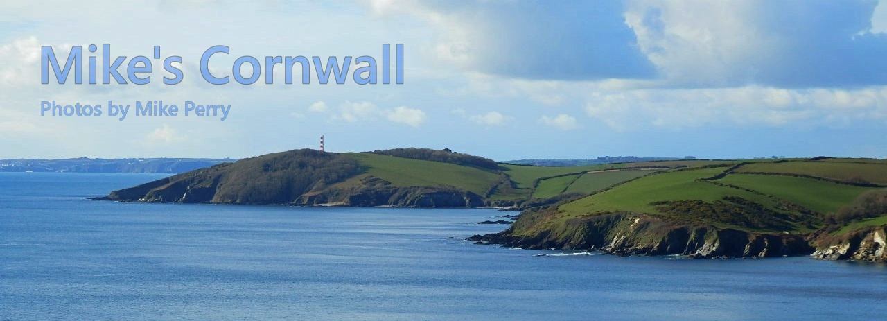
And a final note. Driving into Fowey there is a right turn and then markings which tend to lead you into a carpark. Ignore these (between October and April) and head straight along the road where there are some lovely views - as the early morning photo below.