Tuesday 6 October 2020

A Dozen Photos of South Cornwall Near St. Austell Bay


A dozen mixed photos taken when I was out and about. Must have been up early to catch the misty view of Gribbin Head above - can just make out the Gribbin Tower.

And below a couple of horses pleaded to have their photo taken, so I couldn't refuse. Never look a gift horse in the mouth.


Looking down from the foot bridge over the railway lines at St. Austell. The church always dominates the town.


Here we are now, under a viaduct, looking at the river.


More water and for some inexplicable reason it made me think of the biggest high quality gold nugget ever found which weighed more than 150 lb. No, it wasn't found in Cornwall but was discovered by two Cornish men, John Deason and Richard Oates in 1869. They found it when prospecting near Moliagul in Australia. The men sold it for £9,532. According to an Internet calculator this would be 793263.07 in today's money! 
A terrace of old cottages ...


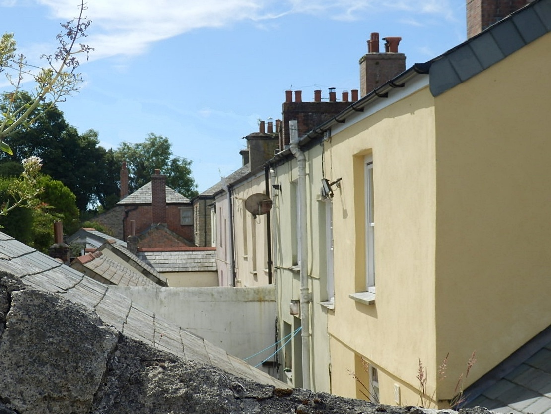
... and a few more overlooking the countryside.
A small cul de sac and in the distance the only high rise block of flats in Cornwall.


If in Cornwall the sea is never too far away - a bollard for boats, not that there were any about, but I remember it had rained quite heavily thus the puddle.


A sea wall built of local stone ...


... and someone walking on the wall.


The glistening sea at the end of another busy day.


Friday 2 October 2020

A Return to Charlestown Harbour and the Old Sailing Ships

We hadn't been to Charlestown since July because of the coronavirus but, on a chilly day, with only a few people about, we decided to see if any old sailing ships where in dock.

Looking over the wall, behind the building above, all looked very bright and inviting.
Usually there are lots of people walking the harbour walls but all was quiet.


Yes, there were old sailing ships in dock - though the weather was on the change.


A side view of the same sailing ship, with some of the harbour cottages looking down.


The photo below is looking upwards to the top of the main mast. A platform is often seen on such ships, way above the deck. It was known as 'The Fighting Top'.

The Fighting Top was an enlarged top, sometimes with swivel guns designed to fire down on the deck of an enemy ship. They could also be manned by snipers with muskets or rifles.
But all was peaceful while we were there and the canons were quiet.


Another view of one of the tall ships.


The morning was definitely getting colder. One family was crossing the narrow bridge homeward bound.


Looking over at the stony beach again a couple looked decidedly chilly but, good gracious, one hardy woman was having a swim! You can just see her head at the bottom of the photo. I preferred to have a cup of tea!


Three previous posts on Charlestown:

Tuesday 29 September 2020

A Choice of Walks in Looe, Cornwall


A quick post today. Looe has some lovely walks other than walking through the town or alongside the river.

Three such walks start in the Millpool car park, where most visitors usually park their cars.


The car park is next to the river, so has some lovely views taking in Kilminorth Woods. 

One of the walks includes a visit to the Giants Hedge, believed to be a 6th century earthwork. Probably built for defence purposes.


All of the walks begin at the far end of Millpool car park where there is a large wooden gate and a map / information board. There are a choice of three colour coded walks. The photo below is where the walks start out.


So everything is nice and easy and you shouldn't get lost! But, of course, there is a snag: you have to pay a car parking fee. On my last visit the charges were as follows.

~ Up to 1 hour - £0.70
~ 1 to 2 hours - £2.30
~ 2 to 3 hours - £3.60
~ 3 to 4 hours - £4.70
~ 24 hours - £5.70


Also see my recent post on Looe itself:


The Fishing Port of Looe, Cornwall

Saturday 26 September 2020

Walking to Chapel Point and Colona Beach Cornwall


Today's post, sort of follows on from my previous post. The photos above and below show one of my favourite houses, somewhere I would love to live but, unfortunately, I'm a few million short at the moment!

Chapel Point house is high on a headland, and is near the coastal path mentioned in my last two posts.


Below the house is a small cove and Colona beach. It's often described as a private beach, but is quite accessible to the public.

On our walk, along the coastal path, we tarried here awhile to devour our packed lunch.


I snapped a few photos.


It was quite a windy day so the waves crashed a little as they reached the beach.


Lots of rockpools to investigate.


As can be seen there are a set of steps leading down to the beach from Chapel Point House.


Colona Beach is backed by sandy cliffs.


I nearly missed the bird as he blended in so well with the cliffs.


From the coastal path it can be seen that Chapel House is actually a cluster of several buildings. These were designed by the arts and crafts designer John Campbell in 1936.

The property is now Grade II listed.

Thanks for visiting my blog.

Wednesday 23 September 2020

Walking Cornwall's Coastal Path From Portmellon


Following on from my previous post, after spending some time at Portmellon, we walked to the coastal path.


The path is easy to find: follow the road west from Portmellon (on foot). Turn first left where there is a coastal path sign and simply follow the other signs!


The path has lots of ups and downs as can be seen by the photos.


The tide was out so the sea had various shades of blue and green.


I like to see the sea caressing the dark rocks.


Looking back, as the path climbs once more.


The bracken was dry, thanks to the sunshine, but contrasts perfectly with the colours of the sea.


Because of a time commitment, and spending too long at Portmellon, we didn't reach Goran Haven, where this part of the coastal path ends - and also where another begins!

It was a perfect day though: sunshine, warm wind and fresh air filling our lungs with goodness.

I feel so lucky to live in Cornwall.


See also:

Sunday 20 September 2020

Portmellon, Cornwall - a Sandy Cove When the Tide is Out


We were heading off for a walk along Cornwall's coastal path and stopped off at Portmellon to park our car in a side road. We have friends who live nearby, so know of a parking spot. I snapped a few quick photos.


Portmellon is only about a mile from Mevagissey, but the road can be a bit hairy as it is so narrow. There is a detour, but this adds miles to the journey.


Opposite the small beach is the Rising Sun pub with locally sourced food.


The beach is sandy but there is a snag: it disappears at high tide with the sea almost lapping the road. 

The beach does have it's own slipway.


There are some very pleasant - and very expensive - houses overlooking the beach. Some of the old houses fortunately remain.


I mentioned that the sea almost laps the narrow road. At times though, it very much overlaps the road as can be seen by the following two photos. I snapped these a while back, when the weather was a bit rough - to say the least!


Houses along the road have flood gates and similar defences for when the water spills across the road, sometimes causing local flooding.


That's all for today, thanks for visiting my blog.

A couple of Mevagissey Posts:

FEATURED POST

A Walk to Pentewan Village, Beach and Harbour

It was a sunshine day so we decided on a walk to Pentewan along the Pentewan Trail starting from the bridge as shown above. ...